


Hurricane Lee is rewriting old rules of meteorology, leaving experts astonished at how rapidly it grew into a goliath Category 5 hurricane.
Lee — which just as quickly dropped to a still-dangerous Category 3 and held that strength Saturday — could still be a harbinger as ocean temperatures climb, spawning fast-growing major hurricanes that could threaten communities farther north and inland, experts say.
“Hurricanes are getting stronger at higher latitudes,” said Marshall Shepherd, director of the University of Georgia’s atmospheric sciences program and a past president of the American Meteorological Society. “If that trend continues, that brings into play places like Washington, D.C., New York and Boston.”
As the oceans warm, they act as jet fuel for hurricanes.
During the overnight hours Thursday, Lee shattered the standard for what meteorologists call rapid intensification — when a hurricane’s sustained winds increase by 35 mph (56 kph) in 24 hours.
With super-warm ocean temperatures and low wind shear, “all the stars were aligned for it to intensify rapidly,” said Kerry Emanuel, professor emeritus of atmospheric science at the Massachusetts Institute of Technology.
Category 5 status, when sustained winds are at least 157 mph (253 kph), is quite rare. Only about 4.5% of named storms in the Atlantic Ocean have grown to a Category 5 in the past decade, said Brian McNoldy, a scientist and hurricane researcher at the University of Miami.
More intense major hurricanes also are threatening communities farther inland, because the monster storms can grow so powerful that they remain dangerous hurricanes for longer distances over land.
Although it’s too early to know how close Lee might come to the U.S. East Coast, New Englanders are keeping a wary eye on the storm. As it creeps closer, it could bring high seas and rip currents up and down the Eastern Seaboard.
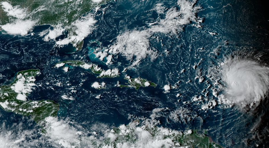
On Saturday, large swells battered the northeast Caribbean as Lee churned through open waters hundreds of miles off the northern Leeward Islands.