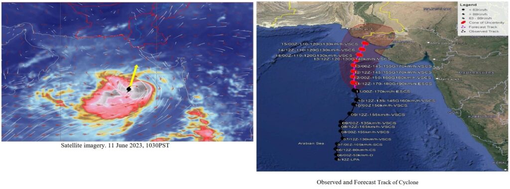
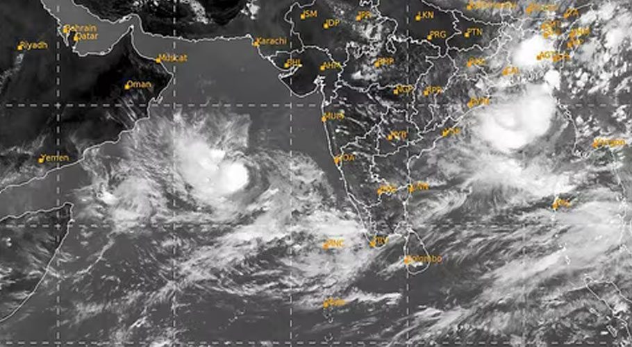
Karachi, June 11, 2023 – The weather authorities have upgraded Tropical Cyclone “BIPARJOY” to an Extremely Severe Cyclonic Storm (ESCS), as it intensifies over the east-central Arabian Sea. The storm has been steadily moving northward in the past 12 hours and is currently positioned near Latitude 18.1°N and Longitude 67.5°E, approximately 760 kilometers south of Karachi, 740 kilometers south of Thatta, and 840 kilometers southeast of Ormara.
With maximum sustained surface winds ranging from 150 to 160 kilometers per hour and gusts up to 180 kilometers per hour at its center, Tropical Cyclone “BIPARJOY” poses a significant threat. The sea conditions surrounding the storm are described as phenomenal, with maximum wave heights reaching 35 to 40 feet. The storm’s intensity is being sustained by favorable environmental conditions, including a sea surface temperature of 30-32°C, low vertical wind shear, and upper-level divergence.
According to the Pakistan Meteorological Department’s cyclone warning center in Karachi, the projected path of ESCS “BIPARJOY” indicates a northward movement until the morning of June 14. Subsequently, it is expected to recurve northeastward and make landfall between Keti Bandar in Southeast Sindh and the coast of Indian Gujarat on the afternoon of June 15 as a Very Severe Cyclonic Storm (VSCS).
The potential impacts of Tropical Cyclone “BIPARJOY” are concerning and demand preparedness measures from the authorities and residents in the affected regions. The following impacts are anticipated:
- Widespread wind-dust/thunderstorm rain, including very heavy to extremely heavy falls, is likely in Thatta, Sujawal, Badin, Tharparker, and Umerkot districts from June 13 to June 17.
- Karachi, Hyderabad, Tando Muhammad Khan, Tando Allayar, and Mirpurkhas districts can expect dust/thunderstorm-rain with a few heavy falls and squally winds of 60-80 kilometers per hour from June 13 or 14 until June 16.
- Structures such as kutcha houses are at risk of damage from the squally winds, which may reach high intensity.
- A storm surge of 3-3.5 meters (8-12 feet) is expected at the point of landfall, particularly around Keti Bandar.
- Fishermen are strongly advised to refrain from venturing into the open sea until the system dissipates by June 17. The Arabian Sea conditions are expected to become extremely rough and accompanied by high tides along the coast.

Issued By: Tropical Cyclone Warning Centre, Karachi
The Tropical Cyclone Warning Centre in Karachi is diligently monitoring the progress of Cyclone “BIPARJOY” and will continue to issue updates as necessary. It is crucial for residents in the affected areas to remain informed and follow the guidance provided by local authorities to ensure their safety and well-being.


