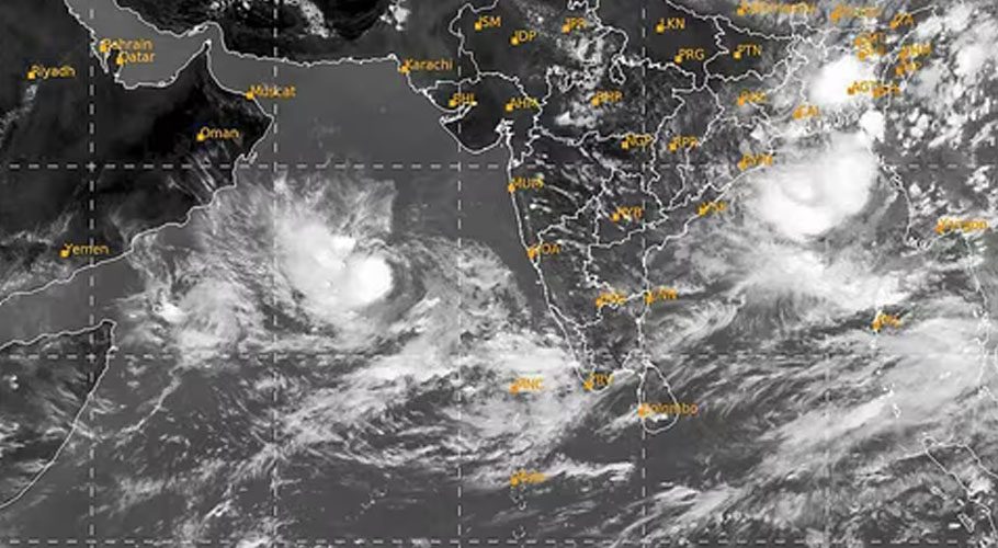
KARACHI: The Pakistan Meteorological Department (PMD) has alerted that cyclone named Biparjoy is maintaining its intensity towards Sindh and Balochistan.
The authorities in Sindh and Balochistan remained alert as Biparjoy was maintaining its intensity and lay 910 kilometres south of Karachi.
It is very likely to intensify further and move north-northeastwards gradually during the next 24 hours, weather reports said. The storm will likely to move gradually north-northwestwards during subsequent three days.
With its probable north-northeast track, the rain-thunderstorm with some heavy falls and squally winds is expected in the Sindh-Makran coast from 13 June night/14 June morning.
‘Biparjoy’ was suggested by Bangladesh and the word means disaster or ‘calamity’ in Bengali. The naming of cyclones is done by countries on a rotational basis, following certain existing guidelines.
The cyclone was initially reported to pose no danger to Pakistan’s coastal areas, however, a day earlier changed its course and began moving towards the coastal areas. As of June 9, it was a little over 1,100km away.
Climate Change Minister Sherry Rehman had advised the provincial disaster management authorities Sindh and Balochistan to “take stock of preparations and ensure public safety for communities in coastal areas”.
Read more: Biparjoy cyclone: Can the alarming storm really damage Karachi?
Subsequently, the provincial disaster management authorities (PDMAs) of Sindh and Balochistan were put on alert and fishermen had also been advised to not venture into the sea.
In a notification issued today, the Met department said the system’s location was “further tracked north-northeastward during past 12 hours and now lies near Latitude 16.7°N & Longitude 66.4°E”.
Read also: Biparjoy cyclone likely to hit Sindh and Balochistan on June 13
Listing the distances from Pakistan’s coastal cities, the PMD said the storm lay at a distance of “about 910km south of Karachi, 890km south of Thatta and 990km southeast of Ormara”.


