


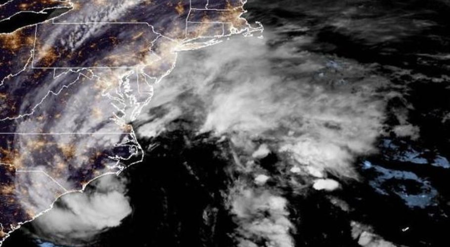
ANNAPOLIS: Tropical storm Ophelia gained strength as it churned toward the North Carolina coast on Friday, promising a weekend of heavy rain and windy conditions throughout the mid-Atlantic.
Forecasters issued a hurricane watch for parts of eastern North Carolina, saying Ophelia showed the potential to gather even more strength as it passes over warm Gulf Stream waters.
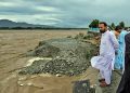
The storm was expected to make landfall in North Carolina on Saturday morning and dump as much as 17.7 centimetres across portions of the state and into southeast Virginia.
The intensifying weather system spun into a tropical storm in the afternoon with maximum sustained winds of 95 km/h, according to the U.S. National Hurricane Center. A storm surge warning was in effect for some areas, with surges between 0.9 and 1.5 metres forecast for parts of North Carolina, the hurricane centre said.
The governors of North Carolina, Virginia and Maryland declared a state of emergency. Some schools closed early as communities prepared for the storm’s arrival, and several weekend events were cancelled.
A storm surge warning was in effect from Beaufort Inlet, North Carlina, to Chincoteague, Virginia, and a tropical storm warning was issued from Cape Fear, N.C., to Fenwick Island, Delaware. It’s not uncommon for one or two tropical storms — or even hurricanes — to form right off the East Coast each year, said Michael Brennan, director of the National Hurricane Centre.
READ MORE: Tropical storm warning issued for US East Coast ahead of potential cyclone
North Carolina Governore Roy Cooper issued his state’s emergency declaration aiming to expedite preparations and help provide a swift response. “The storm’s path has been difficult to predict and we want to ensure that farmers, first responders and utility crews have the tools necessary to prepare for severe weather,” Cooper said.
Virginia Governor Glenn Youngkin’s executive order also sought to ease response and recovery efforts. “We want to ensure that all communities, particularly those with the greatest anticipated impact, have the resources they need to respond and recover from the effects of this storm,” Youngkin said.
The governor encouraged residents to prepare an emergency kit and follow the weather forecast closely. Schools in coastal areas of North Carolina and Virginia announced plans to dismiss students early Friday and cancel after-school and weekend activities.
The North Carolina Ferry System announced it was suspending several routes and the State Emergency Response Team planned to move to an enhanced watch Friday to ease coordination of resources, the governor’s office said.
Meanwhile, Hurricane Nigel was downgraded to a post-tropical cyclone centred about 1,030 kilometres northwest of the Azores, with maximum sustained winds of 110 km/h.
There were no associated coastal watches or warnings as the storm moved northeast at 59 km/h, the hurricane centre said in its final update on the system on Friday morning.
Scientists say climate change could result in hurricanes expanding their reach into mid-latitude regions more often, making storms like this month’s Hurricane Lee more common.
One study simulated tropical cyclone tracks from pre-industrial times, modern times and a future with higher emissions. It found that hurricanes would track closer to the coasts including around Boston, New York and Virginia and be more likely to form along the Southeast coast.