![]() Follow Us on Google News
Follow Us on Google News
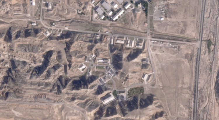
DUBAI, United Arab Emirates: An Israeli attack on Iran damaged facilities at a secretive military base southeast of the Iranian capital that experts in the past have linked to Tehran’s onetime nuclear weapons program and at another base tied to its ballistic missile program, satellite photos analyzed Sunday by The Associated Press show.
Some of the buildings damaged sat in Iran’s Parchin military base, where the International Atomic Energy Agency suspects Iran in the past conducted tests of high explosives that could trigger a nuclear weapon. Iran long has insisted its nuclear program is peaceful, though the IAEA, Western intelligence agencies and others say Tehran had an active weapons program up until 2003.
The other damage could be seen at the nearby Khojir military base, which analysts believe hides an underground tunnel system and missile production sites.
Iran’s military has not acknowledged damage at either Khojir or Parchin from Israel’s attack early Saturday, though it has said the assault killed four Iranian soldiers working in the country’s air defense systems.
Iran’s mission to the United Nations did not immediately respond to a request for comment. The Israeli military declined to comment.
However, Iranian Supreme Leader Ayatollah Ali Khamenei on Sunday told an audience that the Israeli attack “should not be exaggerated nor downplayed,” while stopping short of calling for an immediate retaliatory strike. Israeli Prime Minister Benjamin Netanyahu separately said Sunday that Israel’s strikes “severely harmed” Iran and that the barrage “achieved all its goals.”
It remains unclear how many sites in total were targeted in the Israeli attack. There have been no images of damage so far released by Iran’s military.
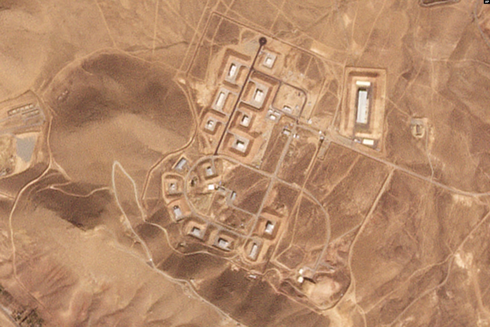
Iranian officials have identified affected areas as being in Ilam, Khuzestan and Tehran provinces. Burned fields could be seen in satellite images from Planet Labs PBC around Iran’s Tange Bijar natural gas production site in Ilam province on Saturday, though it wasn’t immediately clear if it was related to the attack. Ilam province sits on the Iran-Iraq border in western Iran.
The most telling damage could be seen in Planet Labs images of Parchin, some 40 kilometers (25 miles) southeast of downtown Tehran near the Mamalu Dam. There, one structure appeared to be totally destroyed while others looked damaged in the attack.
At Khojir, some 20 kilometers (12 miles) away from downtown Tehran, damage could be seen on at least two structures in satellite images.
Analysts including Decker Eveleth at the Virginia-based think tank CNA, Joe Truzman at the Washington-based Foundation for Defense of Democracies and former United Nations weapon inspector David Albright, as well as other open-source experts, first identified the damage to the bases. The locations of the two bases correspond to videos obtained by the AP showing Iranian air defense systems firing in the vicinity early Saturday.
At Parchin, Albright’s Institute for Science and International Security identified the destroyed building against a mountainside as “Taleghan 2.” It said an archive of Iranian nuclear data earlier seized by Israel identified the building as housing “a smaller, elongated high explosive chamber and a flash X-ray system to examine small-scale high explosive tests.”
“Such tests may have included high explosives compressing a core of natural uranium, simulating the initiation of a nuclear explosive,” a 2018 report by the institute says.
In a message posted to the social platform X early Sunday, the institute added: “It is not certain whether Iran used uranium at ‘Taleghan 2,’ but it is possible it studied the compression of natural uranium hemispheres, which would explain its hasty and secretive renovation efforts following the IAEA’s request to access Parchin in 2011.”


